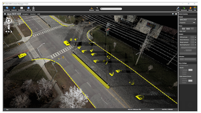
LiDAR is an abbreviation for Light Detection and Ranging. It is a type of active remote sensing that use a laser to measure ranges (varying distances) to the surrounding environment. When paired with GPS and Inertial Navigation System (INS) data, the laser generates an exact dimension, shape, and location on Earth in 3D.
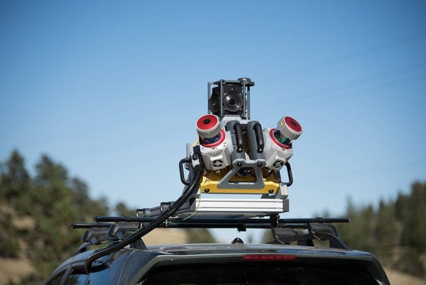
Mobile LiDAR is used to accurately map and survey routes from the street level. High-speed mapping of roads, highways, and railways is possible without disrupting traffic.
The benefits of mobile LiDAR include:
- High density, high accuracy geospatial data
- the Ideal solution for extracting street features as lines, polygons, or points.
- Cost effective on linear projects
- Provide rapid documentation of existing conditions.
The global LiDAR market size was valued at USD 1.81 billion in 2021 and is expected to expand at a compound annual growth rate (CAGR) of 9.8% from 2022 to 2030. The technological advancements in spatial resolution of LiDAR-based digital terrain models are providing better accuracy in applications such as change detection on hillsides, water runoff for agriculture or mining sites, and inland waterways. The growth of the market is attributed to the rising automation in LiDAR to reduce human efforts and increase efficiency.
The rising demand for 3D imagery in application areas such as military & defense, topographical surveys, civil engineering, and corridor mapping is expected to drive market growth over the forecast period. Textured 3D imagery is applied in applications such as 3D mapping, city planning, and corridor mapping. The installation of advanced safety features is increasing exponentially. Moreover, in countries such as the U.S., self-driving cars are approved by the government on the road; these vehicles are integrated with LiDAR for GPS and navigation applications.
LiDAR is also used in monitoring weather conditions and environmental monitoring. For instance, the Canadian environment monitoring stations utilize LiDAR technology to monitor tropospheric pollution. LiDAR stations are crucial in monitoring the ash from volcanic eruptions that can interfere with air travel. The technology also finds its application in mapping the oil sand monitoring system. These multiple applications of LiDAR technology owing to its enhanced accuracy are expected to propel the growth of the market over the forecast period.
The lack of educated customers is considered a major restraint for the growth of the market. Ascertaining the scope of customer education is essential to reduce the costs of implementing and designing such customer awareness and education programs. Customer education and awareness are crucial for improving the capacity of the people to address development and environmental issues and for stimulating sustainable development.
Product Type Insights
The airborne segment dominated the market and accounted for a revenue share of 37.7% in 2021. The growth of the segment is expected to continue for the next few years owing to the increasing adoption of aerial mapping devices. The aerial LiDAR system is an accurate and thorough method of creating digital elevation models, thereby replacing photogrammetry. This system offers more extensive area coverage than its terrestrial counterparts and delivers large area mapping in shorter time intervals.
Read Also: What is Mobile Mapping Market Size?
Terrestrial LiDAR can be both mobile and stationary and operated only on the surface of the Earth. Static terrestrial scanning is a frequently preferred survey method for monitoring, conventional topography, forensics, and cultural heritage documentation. Mobile & UAV LiDAR operates in both mobile and aerial modes and works on Earth’s surface and surrounding environment. The rising adoption of mobile and UAV LiDAR systems and the increasing number of new product launches are expected to draw massive investment from critical participants, driving the growth of the LiDAR market.
In October 2019, RIEGL Laser Measurement Systems GmbH launched the lightweight airborne LiDAR for UAVs. This miniaturized UAV sensor is mainly used for UAV-based applications, which require the acquisition of small objects. Additionally, in September 2021, YellowScan, a France-based UAV LiDAR solutions designer, announced the launch of YellowScan Explorer. It could be mounted on a light human-crewed aircraft or switched to different types of UAV platforms. It allowed end-users to tackle a wide range of projects.
Various competitors in the market offer innovative solutions, which help consumers address changing technologies, business practices, and security needs. Europe comprises notable players who offer advanced solutions to meet varied application requirements. The key players in the market face intense competition to dominate the market, enabling market consolidation through strategic initiatives such as mergers & acquisitions.
Industry participants have entered into a strategic partnership with suppliers and distributors to strengthen their product portfolio and geographical presence. Some prominent players in the global LiDAR market include:
- Faro Technologies, Inc.
- Leica Geosystem Holdings AG
- Teledyne Optech Incorporated (A part of Teledyne Technologies)
- Trimble Navigation Limited
- RIEGL USA, Inc.
- Quantum Spatial, Inc.
- Velodyne LiDAR, Inc.
- Sick AG
- YellowScan
- GeoDigital
LiDAR Market Report Scope
| Report Attribute | Details |
| Market size value in 2022 | USD 2.23 billion |
| Revenue forecast in 2030 | USD 4.71 billion |
| Growth rate | CAGR 9.8% from 2022 to 2030 |
| Base year for estimation | 2021 |
| Historical data | 2017 – 2020 |
| Forecast period | 2022 – 2030 |
| Quantitative units | Revenue in USD million and CAGR from 2022 to 2030 |
| Segments covered | Product type, application, component, region |
| Regional scope | North America; Europe; Asia Pacific; South America; Middle East & Africa |
| Country scope | U.S.; Canada; Mexico; U.K.; Germany; France; China; India; Japan; Brazil |
| Key companies profiled | Faro Technologies Inc.; Leica Geosystems Holdings AG; Trimble Navigation Limited; Velodyne LiDAR, Inc.; RIEGL USA Inc.; Sick AG; YellowsScan; GeoDigital |
| Report coverage | Revenue forecast, company share, competitive landscape, growth factors, and trends |
| Customization scope | Free report customization (equivalent up to 8 analyst’s working days) with purchase. Addition or alteration to country, regional, and segment scope |
| Pricing and purchase options | Avail customized purchase options to meet your exact research needs. |
This report forecasts revenue growth at global, regional, and country levels and provides an analysis of the latest industry trends in each of the sub-segments from 2017 to 2030. For this study, Grand View Research has segmented the global LiDAR market report based on product type, application, component, and region:
- Product Type Outlook (Revenue, USD Million, 2017 – 2030)
- Airborne
- Terrestrial
- Mobile & UAV
- Application Outlook (Revenue, USD Million, 2017 – 2030)
- Corridor Mapping
- Engineering
- Environment
- Exploration
- Advanced Driver Assistance Systems (ADAS)
- Others
- Component Outlook (Revenue, USD Million, 2017 – 2030)
- GPS
- Navigation (IMU)
- Laser Scanners
- Others
- Regional Outlook (Revenue, USD Million, 2017 – 2030)
- North America
- U.S.
- Canada
- Mexico
- Europe
- Germany
- U.K.
- France
- Asia Pacific
- China
- India
- Japan
- South America
- Brazil
- Middle East & Africa
- North America