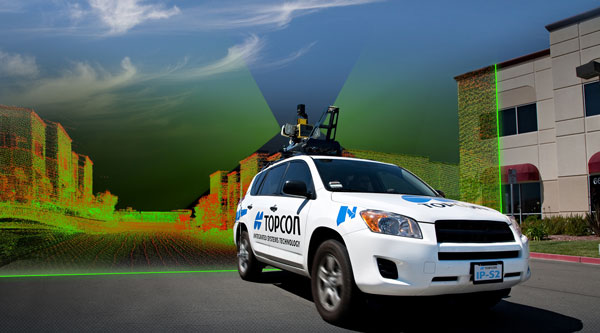
For quite some time, mobile mapping has been all over the news and research publications, owing to its huge contribution to giving location-based information to end users. Here’s an overview of the mobile mapping system. To begin, you may want to understand what mobile mapping is.
The practice of collecting geographical data utilizing a movable vehicle, such as a van, drone, boat, aeroplane, or car, is known as mobile mapping. These geospatial data can be aerial imagery or street-level pictures that have been georeferenced to produce 2D or 3D images. This is performed with the use of several mapping and positioning sensors mounted within a moving vehicle, together called a mobile mapping system, hence the use of ‘system’.
A mobile mapping system includes most or all of the following technologies: digital camera technology, radar, laser, LiDAR, or any type of remote sensing tools combined with GIS and IMU.
1. Leica Pegasus: Two Ultimate – Mobile Mapping System
The Leica Pegasus: Two Ultimate is the ultimate mobile mapping system with endless possibilities. It comes as the successful successor of the Pegasus:Two from Leica Geosystems. It uses two back-to-back camera systems and LiDAR data to produce 360-degrees stitch-free high-resolution imagery at various lighting conditions. The system is capable of enabling a quick survey over a wide geographical area with brilliant accuracy and visualization.
It provides excellent photogrammetry and image quality with the help of 12 MP side cameras and onboard JPEG compression. One of the main features of the system is it offers both point clouds and high-resolution images. Also viewable as an overlay.
Features of the Leica Pegasus: Two Ultimate
- 61° × 47° FOV
- 24 MP panoramic camera system
- Two high-performance laser scanners:
- Z+F Profiler which comes with a range of 120 meters, 360-degree FOV, and a mirror spin rate up to 200 Hz
- Leica P20 which is a modified static scanner for mobile applications with a range of 120 meters
- A removable SSD with integrated 3.0 USB interface
- Telescopic pole to prevent camera head damage
- Multiple sync ports and camera ports
- Cloud-based data storing and sharing
- Room for up to 2 additional external cameras
2. Trimble MX50 – Mobile Mapping System
The new Trimble MX50 is a perfect mid-range mobile mapping system. Given the fact that there is a huge market for asset management and mapping, the company boasts its MX50 as a practical field-to-finish mobile mapping solution for asset management, mapping, and road maintenance.
With improved technology and the company’s various integrated services, MX50 is indeed a practical and economical choice for road inspection and maintenance. Their high-volume data technology works in conjunction with their Geospatial Software Solutions. The best part is, they have implemented their own-made Laser profile technology for the first time. They use Applanix POSpac, a well-known GNSS-Aided Inertial post-processing software for analyzing the spatial data collected from the camera.
Features of the Trimble MX50
- Accurate point cloud along with images for road survey applications
- Two laser scanners with the Trimble LiDAR technology integrated with a reliable mobile platform
- A fixed 360-degree panoramic camera with 30 MP resolution
- Removable SSD card
- A complete field-to-finish workflow- starting from capturing, processing, extracting, and sharing
- Compatible with any smart device
- Simple installation
3. Lynx HS600 – Mobile Mapping System
The Optech Lynx HS600 comes from the house of Teledyne Optech – a leader in high-accuracy 3D LiDAR survey systems, integrated cameras, and productivity-enhancing workflows. Following the Lynx HS series – the Optech Lynx HS600 is a premium mapping solution for high-speed platforms that provide survey-grade accuracy. It comes in two compact configurations as a dual-head Lynx HS600-D and a single-head HS600-S, as a solution to suit different business needs.
Read Also: What is Mobile Lidar Market?
The biggest plus of the Lynx HS-600 is its scanner speed and its flexibility to cater to different solutions. At 600 scan lines per second and an increased measurement efficiency, it captures and delivers high-resolution data at posted vehicle speeds.
The single head configuration is integrated with a Flir Ladybug 5 camera known for its global shutter sensors and high-resolution 360-degree image delivery. On the other hand, the dual head configuration allows for four additional 5-MP cameras along with the Ladybug 5 camera. It comes with in-built QA/QC tools to enable easy optimization of data accuracy without an external toolset.
Features of the LynxHS600
- Unobstructed 360° FOV
- Two high-speed laser scanners – 600 scan lines per second each
- Rich and uniform LiDAR data at highway speeds
- To the point data accuracy plus resolution
- Automated Optech LMS workflow
- Real-time data processing
- Lynx HS600-S can be fully configured to the dual-head version
- Customizable with additional sensors
4. Reigl VMY-2 – Mobile Mapping System
The Reigl VMY-2 is a compact, economical, and efficient mobile mapping system that has a variety of applications including off-shore mining, open pit mining survey, and city modeling. The system consists of two Reigl miniVUX-series LiDAR sensors mounted in a well-proven angled orientation as its predecessors Reigl VMX mobile mapping systems.
This orientation also enables simultaneous forward and backward-looking to reduce scan shadows. The best part is a maximum of four cameras (optional- Ladybug 5+ and Nikon D850) can be integrated into the system and in any combination.
The system is lightweight, easy to fold, and easy to operate. The Reigl VMY-2 has its own Reigl software package that offers comprehensive features in the data processing. They also have a user interface that enables quick and efficient workflow from data acquisition to processing and transferring them to any file format.
Features of the Reigl VMY-2
- 360-degree full circle FOV
- High laser pulse repetition rate of up to 400 kHz
- 200 scan lines per second
- Can integrate up to four additional cameras
- Fully integrated INS/GNSS system
- VM-IU extended disk space to store data
- Multiple target capability
- Eye safe operation at Laser Class 1
5. Mosaic Viking – Mobile Mapping System
Mosaic Viking is the highest resolution 360-degree camera system in the world. This robust camera system comes with six APS-C 31 MP Global shutter sensors that can run up to 5 FPS, enabling high-quality images even at higher highway speeds. It offers large-scale data collection and storage (60 gigabits per second) that is optimized to support digital twins and AR – no wonder it is among the top mobile mapping systems. It captures more realistic 3D models that are used in asset and facility mapping, real estate, media and entertainment, vegetation/ROW management, bridge, tunnel, and street mapping.
Features of the Mosaic Viking
- 22k resolution
- Six APS-C size 31 MP sensors
- Offers a total resolution of over 180 MP
- Global shutter camera sensors
- Seamless operation with six 10-25 GbE ethernet cables
- Showcases real-time data with a live preview
- 12-bit uncompressed original raw data available
There are a lot of great options out there, depending on your needs and of course budget, there is something for (nearly) everyone.