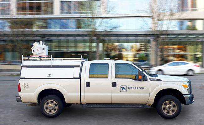
Mobile mapping is quickly becoming an essential tool in the arsenal of many laser scanning specialists.
According to the newest State of the Mobile Mapping Report 2022, mobile mapping is altering the laser scanning and surveying industries, and over two-thirds of survey professionals plan to buy a mobile mapping system within the next two years. With a global market of $127.3 billion by 2031 and a growth rate of more than 5x in just ten years, the chances for a career in mobile mapping are numerous.
Mobile mapping is a type of geospatial surveying that provides architects, designers, engineers, and construction professionals with the digital foundations they need to confidently design and build. Mobile mapping augments existing survey tools by capturing survey-grade data points in extremely complex environments using a mobile device such as a car, UAV, or wearable tool equipped with the latest in laser measuring technology.
The information is combined to form a 3D point cloud or photorealistic depiction of reality. With true-to-life digital documentation of the project, AEC professionals can virtually walk across the site, make educated operational and design decisions, enhance onsite efficiency, and confirm construction activity to within millimetres of the plan.
Mobile mapping is not your standard job. One day you could be capturing as-built data on a construction site; the next, you could be on an offshore oil rig collecting data to detect potential clashes for a new installation. Every day is different, and each site offers its own unique challenges, some of which you can plan for and others you will have to quickly adapt to whilst in the field. That’s what makes the job so interesting and exciting. Flexibility, communication, and teamwork are key.
Working in the field is only half the job. The other half involves processing, aligning, and geo-registering the data at the office or remotely and delivering it to the client online or to be used in downstream, 3rd-party applications. The combination of working across different locations in the field, then having the option of working back at the office or remotely is a great balance.
Mobile mapping technology is redefining traditional survey workflows and has made a huge impact on the way we can collect and visualize data. We love getting our hands on the latest tech and tackling complex projects. The building and engineering industry is constantly evolving with new emerging trends; that’s what makes a career in mobile mapping so exciting, not just now but also for the future.
Read Also: Mobile Mapping Companies
Mobile mapping can be used across a wide range of markets, including:
- Industrial
- Manufacturing
- Public sector
- Education
- Healthcare
- Hospitality
- Retail
- Construction
- Real Estate and Facility Management
- Infrastructure, including railways, roads, bridges, and tunnels
- Mining
- Energy, including Oil, Gas, and offshore,
- Telecommunication
What skills do you need to become a mobile mapper?
- Attention to detail
Passionate about the finer detail and have a methodological and thorough approach.
- Analytical thinker
Lateral-thinker that can see the bigger picture and work to overcome challenges.
- Technologically savvy
Not afraid to learn and take advantage of new technology.
- Deadline driven
Ability to handle responsibility and work to tight deadlines.
- People person
Good communication skills to connect with stakeholders at different levels and work as a team.
- Willingness to travel
Client sites can be based around the region, so the ability to travel is essential.
What qualifications do you need?
Depending on your preference, there are various ways to become a mobile mapper, and entry requirements vary from region to region.
- Academic qualification
Gaining an academic qualification from a college or university is a common route into the industry and, on completion, will give you a recognized certificate. You can study subjects such as surveying, mapping, geospatial science, or related disciplines, including civil engineering, construction, geography, or geophysics.
- Professional qualification
Once you’ve qualified or gained the relevant work experience, you could achieve a professional qualification from your regional governing body. This will help demonstrate professional competence and open a range of career opportunities.
- Apprenticeship
Apprenticeships provide a hands-on practical route that allows you to train whilst on the job, gaining valuable experience and support from coworkers. Apprenticeships are paid and usually a set length of time ending in a recognized qualification, with the potential to progress through the company.
- Work experience
Work experience offers an introduction to the work environment, getting to know the ins and outs of what’s involved in being a mobile mapper. This is a good entry-level way to understand whether the mobile mapping is a career for you.
Maps provide information on a specific area, such as physical features such as hills, valleys, soil, and the natural vegetation that thrives there. Most maps include symbols and are organized into numbered squares (grids) to assist map readers in pinpointing specific regions. It is necessary to learn various skills in order to successfully interpret a map, including:
- The ability to read grid references – a combination of four or six figures which tell you what square or exact position within that square you can find a specific feature on the map.
- The ability to read a compass correctly to help you recognize what direction items on the map are in relation to each other.
- The ability to recognize and read map symbols. These can often be found on the map’s key. Examples of symbols include a red triangle, which represents a Youth Hostel, and a black square with a cross on the top, which represents a place of worship.
- The ability to interpret a map’s scale correctly. This will enable you to understand the relative distance between objects on a map. For example, if a map’s scale is 1:50,000, 1cm on the map represents 50,000cm in real life or half a kilometre.
- The ability to read contour lines. These are brown lines on a map that join places of equal height above sea level. They can be particularly useful when you are hiking in hilly regions as the contour lines give you an idea about the shape of the land.